|
30,607 km² (11,817 miles²) - City population 5,853,677 people Density: 190 people/km² Metro population 19,231,000 people Country: Mexico (+52) - Telecom Zone: Latin America (+5) Elevation: 3,110 m (10,200 ft) Postal Codes: 36-38 Area Code +52 411 |
|
|
| 1) City Pages |
Search by Utilities
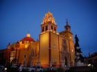 City of Guanajuato
Tourist Office Public Transport Airport
Search by Hotel
|
|---|
| 2) Yellow Pages |
|---|
| 3) White Pages |
Search by Name
White Pages.mx Spokeo.com Linked in.com via PBof.com FB.com via PBof.com more White Pages Paginas Blancas
|
|---|
 |
GPS
Guanajuato Lat: 21° 1' 0" N Long: 101° 16' 0" W Dec: 21.016667°, -101.266667° |
|

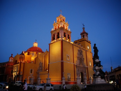 |
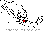
Guanajuato is one of the 31 states which, with the Federal District, are the 32 Federal entities of Mexico. It is located in North-Central Mexico. It is bordered by the states of Jalisco to the west, Zacatecas to the northwest, San Luis Potos� to the north, Quer�taro to the east and Michoac�n to the south. Guanajuato is located between the arid north of the country and the lusher south, and it is geographically part of the Trans-Mexican Volcanic Belt, the Mexican Plateau and the Sierra Madre Oriental. In the pre-Hispanic era, the Bajio saw the most human development due to the fertility of the soil and the presence of surface water for Agriculture.. |
|
Phone Book of Guanajuato: City Directory Yellow Pages and White Pages Pages Jaunes et Pages Blanches Guanajuato Paginas Amarillas y Paginas Blancas Guanajuato Gelbe Seiten und Telefonbuch Guanajuato Pagine Gialle e Pagine Bianche Guanajuato |
|