|
Elevation: 19 m (63 ft) Area Code: +84 28 HO CHI MINH WEATHER |
|
|
| 1) City Pages |
Search by Utilities
 City of Hochiminh
Tourist Office Public Transport Airport
Search by Hotel
|
|---|
| 2) Yellow Pages |
|---|
| 3) White Pages |
|---|
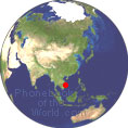
GPS Coordinates Hochiminh: Latitude: 10° 46' 36.8" N Longitude: 106° 42' 2.9" E Decimal:10.776889°, 106.700806° |
||
Hochiminh is the largest city of Vietnam and the 44th largest city of the World. Hochiminh was formerly named Saigon It was once known as Prey Nokor, an important Khmer sea port prior to annexation by the Vietnamese in the 17th century. Ho Chi Minh City has gone by several different names during its history, reflecting settlement by different ethnic, cultural and political groups. Ho Chi Minh City began as a small fishing village likely known as Prey Nokor, "forest city", or perhaps Preah Reach Nokor which, according to a Khmer Chronicle meant "royal city". Ho Chi Minh City is located in the southeastern region of Vietnam. It borders T�y Ninh Province and B�nh Duong Province to the north, Dong Nai Province and Ba Ria�Vung Tau Province to the east, Long An Province to the west and the South China Sea to the south with a coast 15 km (9 mi) long. |
Phone Book of Hochiminh City: City Directory Yellow Pages and White Pages Pages Jaunes et Pages Blanches Hochiminh City Paginas Amarillas y Paginas Blancas Hochiminh City Gelbe Seiten und Telefonbuch Hochiminh City Pagine Gialle e Pagine Bianche Hochiminh City |


