|
Area : 61.177 km2 (23.62 sq mi) City population 640,359 people Density: 190 people/km² Metro population 19,231,000 people Country: Mexico (+52) - Telecom Zone: Latin America (+5) Elevation: 20 m (70 ft) Area Code +52 9933 |
|
|
| 1) City Pages |
Search by Utilities
 City of Villa Hermosa
Tourist Office Public Transport Airport
Search by Hotel
|
|---|
| 2) Yellow Pages |
|---|
| 3) White Pages |
Search by Name
White Pages.mx Spokeo.com Linked in.com via PBof.com FB.com via PBof.com more White Pages Paginas Blancas
|
|---|
GPS Villahermosa Lat: 17° 59' 21" N Long: 92° 55' 41" W Dec: 17.989167°, -92.928056° |
||
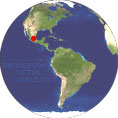
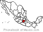
Villahermosa is the capital and largest city of the Mexican state of Tabasco, and the municipal seat of the Centro municipality. Villahermosa is located in the southeast of Mexico between the rivers Grijalva and Carrizal. Founded officially on 24 June 1564 by the Spanish Diego de Quijada on the banks of the Grijalva River under the name of Villa Hermosa, 1826 the village was raised to the rank of city under the name of San Juan Bautista de la Villa Hermosa (Saint John the Baptist). |
Phone Book of Villahermosa: Directory Yellow Pages + White Pages Pages Jaunes et Pages Blanches Villahermosa Paginas Amarillas y Paginas Blancas Villahermosa Gelbe Seiten + Telefonbuch Villahermose Pagine Gialle e Pagine Bianche Villahermosa |


