|
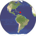
Area : 44.53 sq mi (115.34 km2) City population 208,116 (2001) Density 4,700/sq mi (1,800/km2) Country: Puerto Rico(+1) - Telecom Zone: North America(+1) Elevation: 52 ft (16 m) Zip Codes: 00956, 00957, 00959, 00961, 00960, 00958 Area Code +1 787 BAYAMÓN WEATHER |
|
|
| 1) City Pages |
Search by Utilities
 City of Bayamon
Tourist Office Public Transport Airport
Search by Hotel
|
|---|
| 2) Yellow Pages |
|---|
| 3) White Pages |
|---|
GPS
Bayamon Lat: 18° 22' 48" N Long: 66° 9' 48" W Dec: 18.38° -66.163333° |
||
Bayamon is a municipality of Puerto Rico located on the northern coastal valley, north of Aguas Buenas and Comerio outh of Toa Baja and Catano, west of Guaynabo, and east of Toa Alta and Naranjito. The Taino people, the historic indigenous peoples who encountered European explorers and settlers, were the long time settlers in this area. The Municipality of Bayamon sits on the Northern Coastal Plain region of Puerto Rico. It is bordered by the municipalities of Toa Baja, Catano, Comerio, Aguas Buenas, Toa Alta, Naranjito and Guaynabo. The Spanish colonist Juan Ramirez de Arellano established Bayamon as a Spanish settlement on May 22, 1772. |
Phone Book of Bayamon: City Directory Yellow Pages and White Pages Pages Jaunes et Pages Blanches Bayamon Paginas Amarillas y Paginas Blancas Bayamon Gelbe Seiten und Telefonbuch Bayamon Pagine Gialle e Pagine Bianche Bayamon |


