|
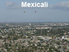
City Population 1,032,000 Mexicali Metro Population 1,102,000 Country: Mexico (+55) Telecom Zone: Latin America (+5) +52 686 short ... PBof.com/mexicali MEXICALI WEATHER |
|
|
| 1) City Pages |
Search by Utilities
 City of Mexicali
Tourist Office Public Transport Airport
Search by Hotel
|
|---|
| 2) Yellow Pages |
|---|
| 3) White Pages |
Search by Name
White Pages.mx Spokeo.com Linkedin via PBof.com FB.com via PBof.com more White Pages Paginas Blancas
|
|---|
 |
GPS
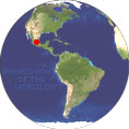
Mexicali: Lat: 32° 40' 0" N Long: 115° 28' 0" W Dec: 32.666667, -115.466667 |
|

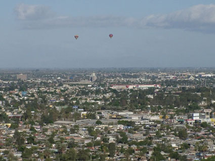 |
Mexicali is the 18th largest city of Mexico, the 56th largest city of Latin America and the xxth largest city of the World. It is the capital of Mexican State of Baja California. Mexicali is also the seat of the Municipality of Mexicali. The city is located on the US/Mexican Border next to California and 200 km south of San Diego. Mexicali is divided into x districts. The name Mexicali comes from the name "MEXIco and CALIfornia". 1903 March 14 foundation of Mexicali. |

|
+52 686 558 1600 City of Mexicali Info Line Numero Ayuntamiento Mexicali |
Phone Book of Mexicali: City Directory Yellow Pages and White Pages Pages Jaunes et Pages Blanches Mexicali Paginas Amarillas y Paginas Blancas Mexicali Gelbe Seiten und Telefonbuch Mexicali Pagine Gialle e Pagine Bianche Mexicali |
|