|
Area : 44.82 km2 (17.31 sq mi) City population : 61,559 (2013) people Density: 1,400/km2 (3,600/sq mi) Country: Sweden (+46) - Telecom Zone: Europe (+3 or +4) Elevation : 104 m (341 ft) Postal Code : 551 xx Area Code +46 36 JÖNKÖPING WEATHER |
|
|
| 1) City Pages |
Search by Utilities
 City of Jonkoping
Tourist Office Public Transport Airport
Search by Hotel
|
|---|
| 2) Yellow Pages |
|---|

| 3) White Pages |
Search by Name
Hitta.se via PBof.com Eniro.se via PBof.com Press Archive Sweden Linkedin via PBof.com FB.com via PBof.com more White Pages Telefonbok
|
|---|
|
|
 |
GPS Jonkoping Latitude: 57° 46' 58" N Longitude: 14° 9' 38" E Decimal: 57.782778°, 14.160556° |
|

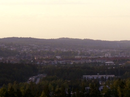 |
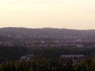
Jonkoping is a city in southern Sweden. It is situated by the southern end of Sweden's second largest lake, Vattern. The original town Jonkoping has grown together with twin city Huskvarna and suburb Norrahammar-Hovslott, forming a contiguous urban area Jonkoping is an old trading center (Koping), since it was on a crossroad for the roads following along the rivers Nissan and Lagan, and the road between the provinces Ostergotland and Vastergotland. This was rather natural due to the geographical position of the city at the southern end of lake Vattern, which divided the two counties. 1284, Jonkoping received city rights as one of the first communities in Sweden. |
|
+46 36 10 50 00 City of Jonkoping Info Line Radhusnummer Jonkoping |
|