|
Area: 1,553 km2 (600 sq mi) City population 3372,859 people Density: 240/km2 (620/sq mi) Country: Colombia (+57) - Telecom Zone: Latin America (+5) Elevation: 442 m (1,450 ft) Area Code +57 8 NEIVA WEATHER |
|
|
| 1) City Pages |
Search by Utilities
 City of Neiva
Tourist Office Public Transport Airport
Search by Hotel
|
|---|
| 2) Yellow Pages |
|---|
| 3) White Pages |
Search by Name
ETB.com via PBof.com Linkedin via PBof.com FB.com via PBof.com more White Pages Paginas Blancas
|
|---|
GPS
Neiva Latitude: 2° 59' 55" N Longitude: 75° 18' 16" W Decimal: 2.998611 -75.304444 |
||
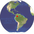
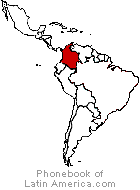
Neiva is the Capital of the Department of Huila. It is located in the valley of the Magdalena River in south central Colombia. Neiva was first founded in 1539 by Juan de Cabrera in an area now belonging to the municipality of Campoalegre. Due to its location near the equator and its low altitude, the city has a hot annual average climate with daytime temperatures ranging from 88 to 95 degrees Fahrenheit.. |
Phone Book of Neiva: City Directory Yellow Pages and White Pages Pages Jaunes et Pages Blanches Neiva Paginas Amarillas y Paginas Blancas Neiva Gelbe Seiten und Telefonbuch Neiva Pagine Gialle e Pagine Bianche Neiva |


