|
204 km² (79 miles²) - City population 650,000 people) Myanmar I93 km, India 4,053 km Elevation: 34 m (112 ft) Postal code: 5400 Area Code: +880 521 RANGPUR WEATHER |
|
|
| 1) City Pages |
Search by Utilities
 City of Rangpur
Tourist Office Public Transport Airport
Search by Hotel
|
|---|
| 2) Yellow Pages |
|---|
| 3) White Pages |
|---|
 |
GPS
Rangpur Latitude: 25° 33' 36" N Longitude: 89° 15' 0" E Decimal:25.56°, 89.25° |
|

|
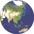
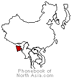
Rangpur is the 7th largest city of Bangladesh. Rangpur is one of the oldest municipality in Bangladesh, and was established in the year 1869 Rangpur was conquered by the army of Raja Man Singh, a commander of the Mughal emperor, Akbar, in 1575, Until 1686 that it was fully integrated into the Mughal Empire. Rangpur is one of seven divisions and is composed of eight districts of the northern Bangladesh. The District of Rangpur is bordered on the north by Nilphamari District, on the south by Gaibandha District, on the east by Kurigram, and on the west by Dinajpur district. |
Phone Book of Rangpur: City Directory Yellow Pages and White Pages Pages Jaunes et Pages Blanches Rangpur Paginas Amarillas y Paginas Blancas Rangpur Gelbe Seiten und Telefonbuch Rangpur Pagine Gialle e Pagine Bianche Rangpur |
|
Phonebook of Bangladesh.com
Phonebook of North Asia.com