|
City Population 1,162,000 Dhanbad Metro Population 1,333,000 Country: India (+91) Telecom Zone: Far East (+9) +91 326 short ... PBof.com/dhanbad DHANBAD WEATHER |
|
|
| 1) City Pages |
Search by Utilities
 City of Dhanbad
Tourist Office Public Transport Airport
Search by Hotel
|
|---|
| 2) Yellow Pages |
|---|
| 3) White Pages |
Search by Name
White Pages.in Spokeo.com Linkedin via PBof.com FB.com via PBof.com more White Pages
|
|---|
|
|
GPS Dhanbad Lat: 46° 34' 51" N Long: 07° 07' 26" E Dec: 43.58083° 7.123888° |
||
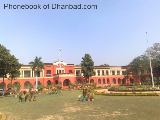
Dhanbad is the 33rd largest city of India. The city shares its boundaries with West Bengal in the Eastern and southern part, Dumka & Giridih in the North and Bokaro in the west. Dhanbad comes under the Chota Nagpur Plateau. Dhanbad is divided into Dhanbad district. The name Dhanbad comes from the name "Dhanbaid ". Dhanbad was founded in 1928 and was incorporated on 24 October 1956. |
Phone Book of Dhanbad: City Directory Yellow Pages and White Pages Pages Jaunes et Pages Blanches Dos Dhanbad Paginas Amarillas y Paginas Blancas Dos Dhanbad Gelbe Seiten und Telefonbuch Dos Dhanbad Pagine Gialle e Pagine Bianche Dos Dhanbad |


